NOTICE: CLOCKWISE COURSE DIRECTION FOR 2026. Different than the race flow and maps shown below.
_________________________________________________
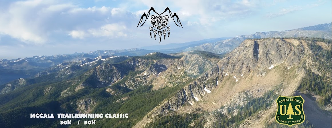
START/FINISH LOCATION:
We will Start and Finish at Pete Creek Trailhead and Dispersed Campground.
Google Maps Link to the Start: https://goo.gl/maps/wgdAbYgEkeh5Ljwi8
Directions are pretty simple. From the west end of McCall, turn north onto Warren Wagon Road and drive 28.2 miles on the paved road. Just before Warren Wagon Road turns to dirt, turn left on Forest Road #246 (AKA Burgdorf Road). Drive the dirt road 4.1 miles to the Pete Creek Trailhead on your left. This road is part of the race course, so please NO DUST and drive carefully. Follow our directions for parking. If cars are parking out on the Burgdorf Road, tuck in tight to the RIGHT/EAST shoulder and park. Watch for trafffic. Walk into the Campground access road towards the back where we will start the race. The free/dispersed campground is open to other campers and user groups, so please be respectful if you are starting at 8AM for the 50K. For the 9AM 30K start, the sun will be high and most people awake.
__________________________________________________________________________
AID STATION SPREADSHEET
2026 McClassic Aid Stations 30K/50K - Google Sheets
__________________________________________________________________________
COURSE MAPS
GPX FILES: GPX mapping files will be available on our Facebook Group Pages for IMTUF100 and McCall Trailrunning Classic- both under the FILES Tab at the top of the main pages. You may need a laptop/desktop to access these, as some people can't see these tabs on their mobile Facebook Apps.
 |
| 30K and 50K Courses. Please note: On the 50K course, the short out and back to Crystal Mountain is happening in 2025 for the fist time ever. |
 |
| 30K Elevation Profile |
 |
50K Elevation Profile. This mapping program generally inflates vertical gain.
Actual climbing is around 6000'. |
30K Walkthrough (and Opening 15 Miles of 50K)
Begin at the far end of the Pete Creek (AKA 3 Mile) Dispersed Campground. Head WEST to the Pete Creek Trailhead and enter a meadow and soon after, cross Lake Creek. Since 2023, this bridge crossing has been an issue and we aim to have the bridge rebuilt ASAP and a permanent bridge in place. For now, there is a temporary crossing, using the remnants of the old bridge. Continue along the meadowy trail, soon entering the forest and begin the climb. The first few miles are fairly gradual and begin to really get steeper at around 4 miles. We have traditionally placed an unmanned water station in this area around 7600' elevation. At Mile 4.75, reach a junction with the Bear Pete Trail #142 and go LEFT/SOUTH. The Bear Pete Trail stays at high elevation, above 8000', and rolls up and down near the ridge crest of the long Bear Pete Mountain massif. At about the 6 mile mark, reach a not obvious 4 way junction. To your right is a signed trail for North Creek (aka Klip Creek)- this is the wrong way. From this junction, you will go LEFT on an obscure ancient lookout caretaker's trail to the top of the Bear Pete Mountain 8752'. We use the trail where it still exists and opt for pleasant open country running/hiking where the trail disappears. The climb is just over 0.5mi and 500' climb to the top. Tag the top, being careful with the cliffy faces below the trail and return to the 4 way junction the way you came up. Once you are back at the 4 Way Junction (approx mile 7), go LEFT/SOUTH and continue along the Bear Pete Trail. It continues rolling along above 8000' a few more miles. At Mile 9, leave the main trail for a less obvious RIGHT TURN into the Frosty Meadows area. Descend briefly and cross a beautiful and lush meadow with a small creek at its bottom, then climb out the opposite side. At Mile 9.5, the Frosty Meadows Trail re-enters open country at a ridge top and re-joins the main Bear Pete Trail. The race course makes a HARD LEFT here and heads EAST. DO NOT CONTINUE SOUTH on the Bear Pete Trail. The Trail descends sharply for 0.25 mile, crosses a small meadow and reaches a signed junction with the Nethker Creek Trail- GO RIGHT/EAST and descend the Nethker Creek drainage. At Mile 10.25 and 7500' elevation, cross a nice spring on your left that is a good place to drink. We will likely have water jugs here as an unmanned water drop. Continue descending a short distance, then climb a 100' roller, then Nethker continues dropping all the way to the trailhead. The Nethker Creek Trailhead is reached at 13.5 miles at an elevation of 6250'. We will have a manned aid station here, The Nethker Creek Aid Station. Some warm forest road running is coming your way, so fill your bottles and fuel up.
NOTE THE CUTOFF HERE: If you are a 50K runner, you must be through this aid station by 1:30PM MST (5hrs 30mins run time). Failure to make this cutoff immediately makes you a 30K runner and you will follow the 30K course back to the finish.
Continue descending the Netheker Creek Road #248, then veer LEFT onto Forest Road #251, which keeps decscending more gradually. Pass through US Forest Service Burgdorf Campground (NOT THE HOTSPRINGS, DIFFERENT PLACE) and reach the French Creek Road #246. Go LEFT on the French Creek Road and soon pass Burgdorf Hotsprings on your right. Continue up the road just a few hundred yards and see Jeanette Creek Campground on your right, about Mile 15.
This is where the 30K and 50K courses diverge...
...30K runners continue on the French Creek Road 2+ miles and turn LEFT into the Pete Creek Campground and run the camp access road to its end and the finish line. Expect most watches to read a bit short, closer to 29K than 30K.
...50K runners read on...
50K Walkthrough
Read the above 30K description to its end, then we diverge from that route on the French Creek Road #246, just beyond Burgdorf Hotsprings at Jeanette Creek Campground. The 30K stays on the French Creek Road back to the finish, the 50K goes RIGHT into the US Forest Service pay campground and runs to the back of the camp access road at the Trailhead for Jeanette Creek Trail #140. Begin climbing. At 6600' elevation, reach the Crystal Mountain Road. THis begins your 0.5mi out and back climb. Turn RIGHT and climb up the jeep road. The climb is 500' vertical and ends at an overlook. Mark your bib with a sharpie marker as instructed and turn around. Descend the way you came up and return to Jeanette Creek Trail. Go RIGHT on the Jeanette Creek Trail and immediately find a water station at mile 16.0. Climb Jeanette Creek. Around Mile 19, pass through a short recently burned area. At Mile 20, reach 8000' elevation and pop into a scenic open country vista and the trail widens. The climb appears to be conquered, but it will hit you with a few severe, heartbreaking false summits over the next 2+ miles. At Mile 22.5, reach the top of Jeanette Creek Trail junction with Forest Road #325. We had proposed this as the aid station location, but have decided to move it 1.6 more miles. Keep going...
The course turns LEFT on Road #325, a high altitude and very scenic jeep road. You will be on this road for 1.6 miles. Road 325 initially descends, then gains some of it back. At mile 24.1, go LEFT on Willow Creek Trail #136 and arrive at the WILLOWTOP AID STATION manned by the Hunt family from McCall. Continue on down the Willow Creek Trail. It is a double track with decent footing throughout. It rolls a bit for the first mile, then around Mile 26, it does some tight switchbacks and drops about 800' quickly to bring you down to creek level, where the descent is gradual again. At Mile 28, cross Willow Creek on a bridge and the trail transitions to a forest road. There will be an unmanned WATER STATION here at the bridge. The forest road continues descending another 2 miles to reach the dirt French Creek Road #246 at Mile 30. Turn LEFT on the main road and go 1.3 miles and turn RIGHT into the Pete Creek Campground road and run the access road back to the FINISH where you started.


No comments:
Post a Comment
Note: Only a member of this blog may post a comment.